Know your course. Every metre of it.
We walk your course once with a 3D laser scanner and you own a true 3D map of it, accurate to a few centimetres. FJD GolfMind turns that map into drainage plans, a tree inventory, real square-metre measurements, a sprinkler map, and the mowing zones your autonomous mowers follow.
Where does your course knowledge live today?
Where the wet spot on 7 is. Which sprinkler heads stick. Which spruce is dying. The day that person retires, the course forgets.
Irrigation drawings show what was designed, not what is in the ground after twenty years of repairs and reroutes.
Every drainage job, bunker rebuild or spray program starts with someone pacing it off with a wheel and a notepad.
How a course gets mapped
One box on the property gives the scanner and every mower centimetre-accurate positioning. Done once.
Carry the scanner on greens, tees and bunkers; mount it on a cart for fairways and rough. The 3D map builds live on the tablet.
Boundaries, bunkers, water, cart paths and sprinkler heads, tapped in with the handheld marker.
The map, the reports, the mowing zones and the mower fleet, all in one screen. Your data, exportable in standard formats.
Four jobs it does for the grounds crew
Slopes, elevation changes and where water wants to go, with every low spot flagged before the digger arrives.
Every tree picked out of the scan and numbered, with height and trunk size. Add your own maintenance notes.
Draw round a bunker or fairway and read the area straight off, in square feet or acres. Order the right sand, fertilizer and spray.
Sprinkler heads, valves, control boxes and drainage points where they really sit, as searchable layers. Know where to dig.
See it working
What FJD says courses save
The scanner behind it
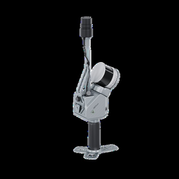
GolfMind is powered by the FJD Trion S2 Max handheld 3D laser scanner and the V4e Pro geospatial marker. Carry the scanner, drive it on a cart, or fly it on a drone; it captures terrain, trees, bunkers, paths, water and course structures into a real 3D model, and keeps its bearings under trees where GPS alone gives up.
- Scanning is included in the mapping service
- Scanner also available to buy for courses that want to re-scan on their own schedule
- Full specifications and pricing on request